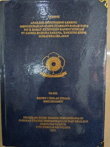
INSAGI, RENDY CHOLAS and Pebrianto, Rosihan and Gobel, Alieftiyani Paramita (2025) ANALISIS MONITORING LERENG MENGGUNAKAN SLOPE STABILITY RADAR PADA PIT E BARAT EXTENSION BANKO TENGAH PT SATRIA BAHANA SARANA, TANJUNG ENIM, SUMATERA SELATAN. Undergraduate thesis, Sriwijaya University.
![[thumbnail of RAMA_31201_03021282126037_cover.jpg]](https://repository.unsri.ac.id/183860/1.hassmallThumbnailVersion/RAMA_31201_03021282126037_cover.jpg)  Preview |
Image
RAMA_31201_03021282126037_cover.jpg - Accepted Version Available under License Creative Commons Public Domain Dedication. Download (186kB) | Preview |
|
Text
RAMA_31201_03021282126037.pdf - Accepted Version Restricted to Repository staff only Available under License Creative Commons Public Domain Dedication. Download (3MB) | Request a copy |
|
|
Text
RAMA_31201_03021282126037_TURNITIN.pdf - Accepted Version Restricted to Repository staff only Available under License Creative Commons Public Domain Dedication. Download (5MB) | Request a copy |
|
|
Text
RAMA_31201_03021282126037_0010029003_0021089302_01_front_ref.pdf - Accepted Version Available under License Creative Commons Public Domain Dedication. Download (685kB) |
|
|
Text
RAMA_31201_03021282126037_0010029003_0021089302_02.pdf - Accepted Version Restricted to Repository staff only Available under License Creative Commons Public Domain Dedication. Download (1MB) | Request a copy |
|
|
Text
RAMA_31201_03021282126037_0010029003_0021089302_03.pdf - Accepted Version Restricted to Repository staff only Available under License Creative Commons Public Domain Dedication. Download (605kB) | Request a copy |
|
|
Text
RAMA_31201_03021282126037_0010029003_0021089302_04.pdf - Accepted Version Restricted to Repository staff only Available under License Creative Commons Public Domain Dedication. Download (555kB) | Request a copy |
|
|
Text
RAMA_31201_03021282126037_0010029003_0021089302_05.pdf - Accepted Version Restricted to Repository staff only Available under License Creative Commons Public Domain Dedication. Download (181kB) | Request a copy |
|
|
Text
RAMA_31201_03021282126037_0010029003_0021089302_06_ref.pdf - Bibliography Restricted to Repository staff only Available under License Creative Commons Public Domain Dedication. Download (183kB) | Request a copy |
|
|
Text
RAMA_31201_03021282126037_0010029003_0021089302_07_lamp.pdf - Accepted Version Restricted to Repository staff only Available under License Creative Commons Public Domain Dedication. Download (1MB) | Request a copy |
Abstract
Slope stability is a persistent geotechnical challenge in the mining industry, necessitating meticulous planning in the design of mine slopes. Even after a slope design is confirmed as safe, continuous monitoring is essential, as initially stable slopes can become unstable due to slope movements, ultimately leading to failure. Currently, one of the most advanced and accurate slope monitoring methods is ground radar technology, developed by GroundProbe, which offers precision of up to 0.04 mm using the SSR-XT system. PT Satria Bahana Sarana utilizes the SSRXT to monitor slopes in a coal mining front, as the area has experienced landslides in the past. This study aims to identify the types of slope deformation occurring in the area, predict the timing of potential landslides, and provide geotechnical alarm recommendations for slope stability. The monitoring data obtained from the SSR includes deformation, coherence, velocity, and pixel. This data was processed using Microsoft Excel to generate monthly classifications of slope deformation, praphs and tables forecasting landslide timing, and Upper Control Limit (UCL) and Critical Value results for the slope. At pixel coordinates x = 36, y = 17, the slope exhibited three deformation patterns: linear, progressive, and regressive, ordered from most to least frequent. Among the three Velocity Change Point (VCP) models applied, VCP 360 provided the closest estimate to the actual landslide occurrence. The recommended alarm threshold (UCL) was set at 5.69 mm/hour, while the Critical Value for slope failure was determined to be 22.96 mm/hour.
| Item Type: | Thesis (Undergraduate) |
|---|---|
| Uncontrolled Keywords: | Lereng, Pemantauan, Deformasi, Longsor |
| Subjects: | T Technology > TN Mining engineering. Metallurgy > TN1-997 Mining engineering. Metallurgy |
| Divisions: | 03-Faculty of Engineering > 31201-Mining Engineering (S1) |
| Depositing User: | Rendy Cholas Insagi |
| Date Deposited: | 12 Sep 2025 07:28 |
| Last Modified: | 12 Sep 2025 07:28 |
| URI: | http://repository.unsri.ac.id/id/eprint/183860 |
Actions (login required)
 |
View Item |
